
Official road
| Location | City of Chikushino・City of Kasuga・City of Onojo・City of Dazaifu・Town of Kiyama |
|---|---|
| Designation | Undesignated |
| Emblem |  |
This is a straight road that passes through the West and East Gate of Mizuki Fortress, which serves as the entrances to Dazaifu. The Nishimon (West Gate) Route is a road connecting Tsukushi Hall (Koro Hall ruins) to Dazaifu, and was used by foreign envoys to enter Dazaifu. The Higashimon (East Gate) route connected to Hakata and is believed to be the route used by official from the capital. Both the West Gate and East Gate routes are currently still in use as city roads. Official roads run toward Dazaifu from Chikugo, Hizen, Bunzen, Bungo, and other places around Kyushu, creating a flow of people and cultural artifacts and supporting the development of Dazaifu.
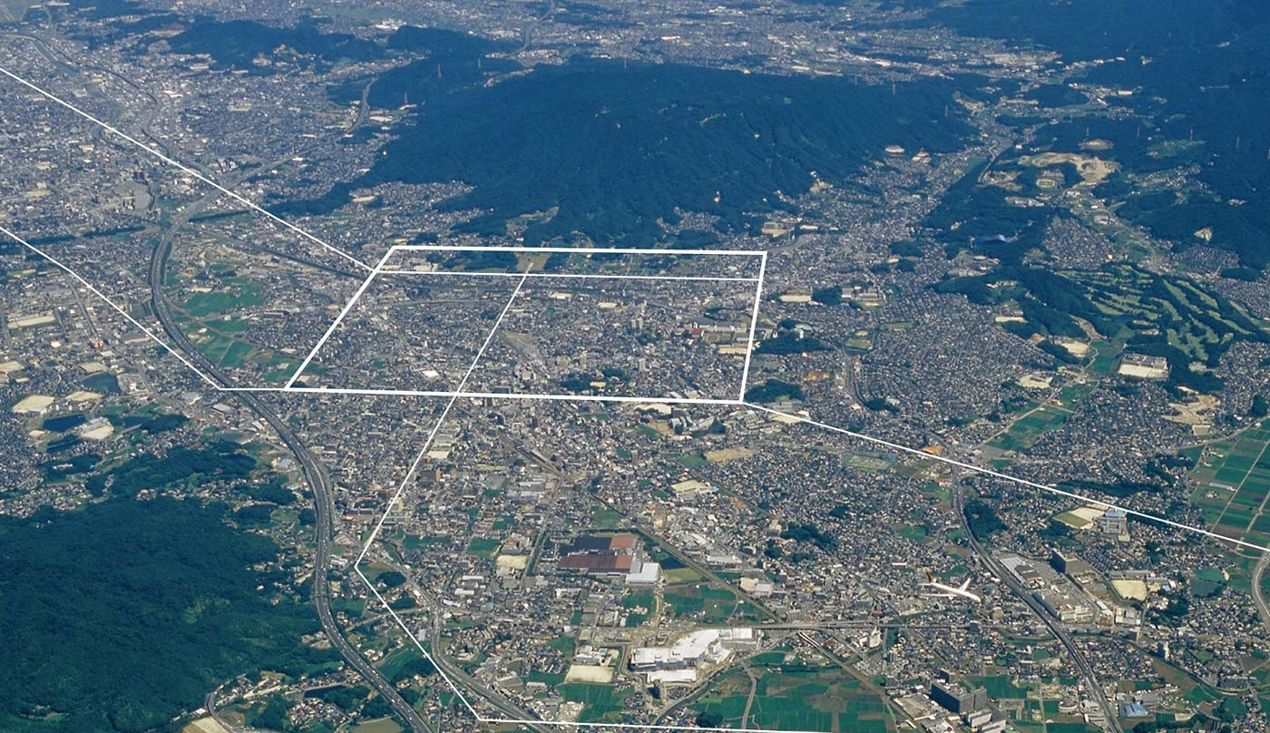
A Network of Roads Supporting Exchange
A center of political and cultural exchange, the "Western Capital" was also the nexus of the ancient road network. In particular, the road passing through Mizuki Fortress, the entrance to the “Western Capital”, led to the capital and abroad. The road passing through the west gate of Mizuki Fortress connected Dazaifu with Koro Hall, an inn for foreign envoys situated on a hill facing Hakata Bay, and was travelled by foreign envoys and merchants. The road passing through the East gate of Mizuki Fortress passed from Dazaifu to nearby present-day Hakata, and led from the Sanyo-do Road via Munakata and Onga. Stretching south from Dazaifu was a road leading to such areas as Hizen, Higo, Bunzen, and Bungo. These official roads had a standard width of 9 to 10 meters and were built by carving through the hills and filling valleys to create straight roads. The network of roads established around Dazaifu served as an exchange network connecting Kyushu to the capital and abroad.
A Road Traveled By Foreign Envoys
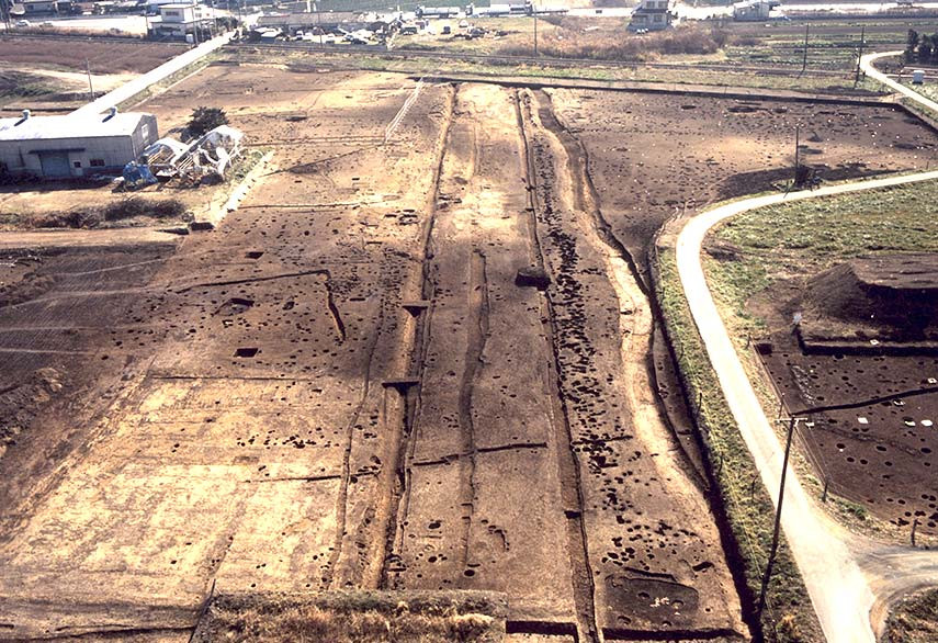
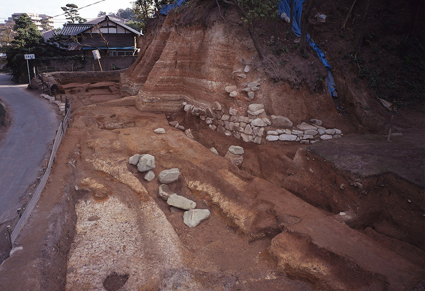
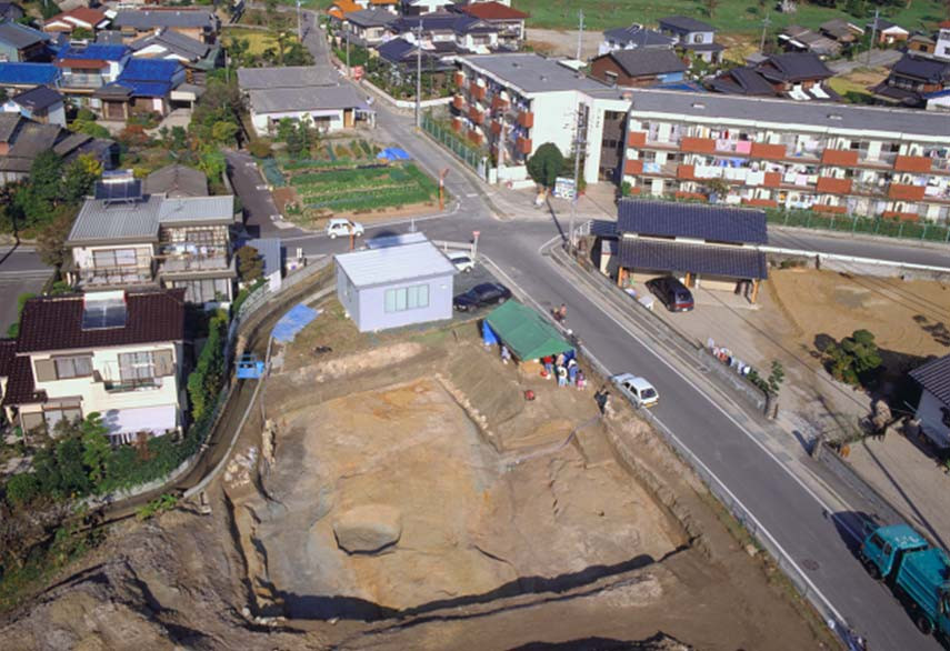
The official road (Mizuki West Gate Route) connecting Dazaifu with Koro Hall, an ancient guesthouse standing on a hill facing Hakata Bay, was the route traveled by foreign envoys on their way to Dazaifu, and archaeological excavations have been conducted at multiple sites so far. The ruins of Kasuga Park were excavated in 1978, the first survey of an ancient official road in Kyushu. This survey found a straight road 9 meters wide and 200 meters long with ditches on either side. The road surface was level and hardened. Relics from around the 9th century were unearthed in the ditches, leading scientists to believe that road maintenance was neglected around this time. The Sakinoharu site is located 200 meters north of the Kasuga Park site. Surveys so far have identified a road approximately 9 meters wide. Surveys have also been conducted on sites such as Gokuden, Ikeda, and Tanigawa.

Dazaifu City Characters/Tabito the Traveler, Otomo no Tabitto, Princess Reiwa
Come visit Mizuki Fortress to experience for yourself these ancient official roads.
In antiquity, there were two official roads from Dazaifu to the Fukuoka Plains of the northwest, and blocking these was Mizuki Fortress, called “Mizuki-no-seki” (“the Barrier of Mizuki Fortress”). The place where these official roads and Mizuki Fortress meet are the east and west gates of Mizuki Fortress.
The official road passing through the east gate gradually grew narrower and narrower, and in the Middle Ages and Early Modern era was used to connect Hakata and Dazaifu; it then became National Route 3, and is currently used as a prefectural road.

Chikushino City Characters/Tsukushi-chan
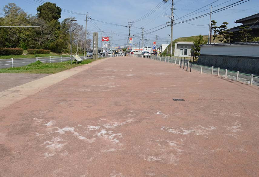
Looking north from Suita Hot Springs (Futsukaichi Hot Springs) offers a spectacular view of the straight road stretching onward. This road is located on an extended portion of Suzaku Avenue (due south), which stretches north to south in the center of the Dazaifu grid. There is also a village subsection on the land along this long north-south road named “Yu-no-omichi” (“Hot Spring Avenue”). Areas with the name “Omichi” (“avenue”) often stem from ancient townscapes, and the location suggests that this road is a remnant of an official road. Perhaps officials and priests of Dazaifu took “Yu-no-omichi” on their way to Suita Hot Springs.

Kasuga City Characters/Kasuga-kun and Asuka-chan
The Kasuga Park site has become a park with green spaces and retention basins and thus ruins cannot be seen now, but there are explanations boards that tell of its history within the Kasuga Park (along the Retention Basin Southeast Running Course).
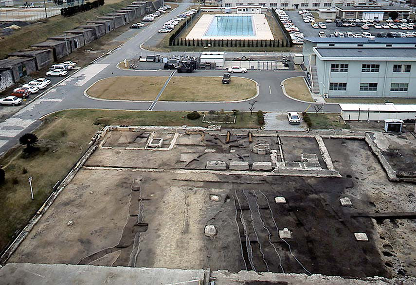
In the cornerstone area of the Suguokamoto Site, located on a hill overlooking the official road (West Gate route), two dugout pillar buildings accompanied by tiles from the latter half of the 7th century to the 8th century have been excavated. The relationship between the ruins of this building and the official road passing below is being studied.
Access Information
Address
Mizuki Fortress East Gate Ruins:818-0132 2-17-11 Kokubu, Dazaifu,Fukuoka
Mizuki Fortress West Gate Ruins:816-0952 4-12 Shimoori, Onojo, Fukuoka
By Train
East Gate:About 20 min on foot from Nishitetsu Tofuromae Station
West Gate:About 5 min on foot from JR Mizuki Station

About the Western Capital
The “Western Capital”, created in Tsukushi 1300 years ago. Cultural assets speaking to the magnificence of this city of international exchange that flourished in East Asia are scattered across the cities of Chikushino, Kasuga, Onojo, Dazaifu, Nakagawa, and Umi in Fukuoka Prefecture as well as the town of Kiyama in Saga Prefecture.